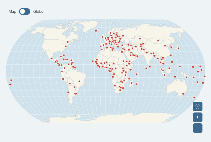
This world map shows the capital city of every country, 196 in all. Hover over a red star to see the capital and its country, zoom in to see all the capital names right on the map, or switch to the globe to spin the Earth.
- Hover over a star to see the capital and its country
- Zoom in (scroll, double-click or the + button) and the capital names appear on the map
- Use the Map / Globe switch in the top-left corner to turn the map into a 3D globe
- Drag to move around, hold Shift and drag to zoom into an area, and use the home button to see the whole world again
More to explore on DataViz Dojo
Make it your own
Want your own version of this map? Click Edit this chart to open it in the amCharts Editor. Change the colors, add your own cities or pins, highlight countries or map your own data, then export it or share it with a link. No coding needed.
For developers
This is an amCharts 5 MapChart with the Natural Earth projection (am5map.geoNaturalEarth1()). The Map / Globe switch swaps it for am5map.geoOrthographic() and makes vertical dragging rotate the globe. The capitals are a MapPointSeries fed with plain latitude and longitude data, each drawn as an am5.Star with a label. All the labels share one Template, so a single chart.on("zoomLevel") handler shows them once the map is zoomed in to level 3. The list of capitals comes from Natural Earth, a public-domain map dataset. The full JavaScript, TypeScript and JSON source is below.
Related demos
Related tutorials
Build this chart with AI
The prompt below can be used to build this chart with AI. For best coding results, use the most advanced AI models, like Claude Opus 5 and GPT-5.6-Codex. For more info and tips, check out amCharts AI docs.
Create an interactive world map with the capital city of every country shown as a red star, capital names that appear when you zoom in, and a switch between a flat map and a 3D globe. Use amCharts 5 library.
Demo source