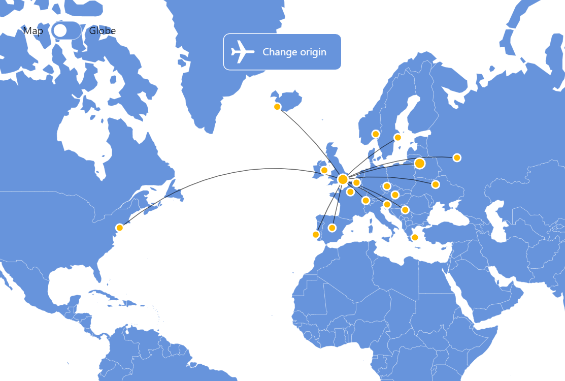
Flight Routes Map
This demo shows how we can use MapChart API to draw map markers and lines using latitude/longitude coordinates.
Related tutorials
Build this chart with AI
The prompt below can be used to build this chart with AI. For best coding results, use the most advanced AI models, like Claude Opus 4.6 and GPT-5.3-Codex. For more info and tips, check out amCharts AI docs.
Create an interactive flight routes map displaying connections from two selectable origin cities (London and Vilnius) to approximately 10 destination cities each across Europe. Use large golden markers at the origin cities and smaller markers at destinations, both with white borders. Draw faint connection lines between the active origin and its destinations. Add a 'Change origin' button and make origin markers clickable with '(Click me!)' tooltip prompts. When switching origins, update the lines and auto-zoom to the appropriate regional view. Include a Map/Globe toggle for switching between flat and 3D projections. Show a subtle graticule grid. Animate on load. Use amCharts 5 library.
Demo source