This short tutorial will show how you can use MapChart with a version of world map that is compatible with regulations in place in India.
Two versions of maps
Regulations in India require contested areas to be shown as part of the country as a whole. Unfortunately, those border lines do not correspond with areas of direct control.
This is our default map world* (e.g. worldLow) shows UN-mandated version of borders.
To solve this specific issue, amCharts 4 comes with a specific version of world map, called worldIndia*.
So, to use Indian version of the world map, all you need to do is to import/include and use worldIndia map instead of world one.
chart.geodata = am4geodata_worldIndiaLow;
chart.geodata = am4geodata_worldIndiaLow;
{
  // ...
  "geodata": "worldIndiaLow"
}

geodata = am4geodata_worldLow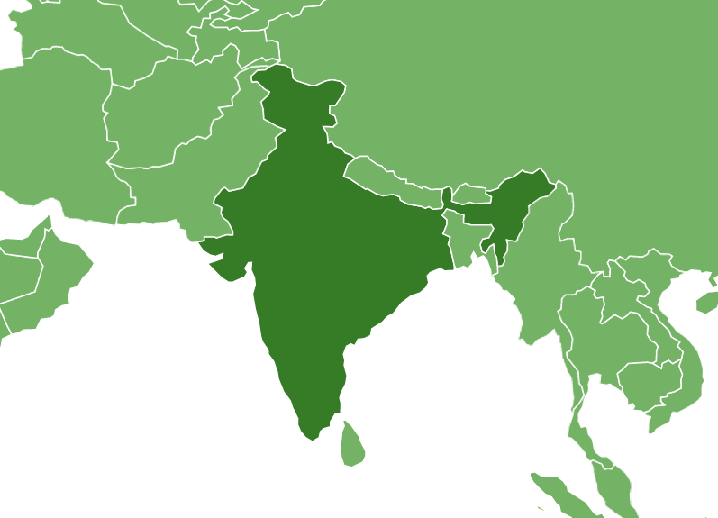
geodata = am4geodata_worldIndiaLow
Example
See the Pen amCharts 4: India world map by amCharts team (@amcharts) on CodePen.