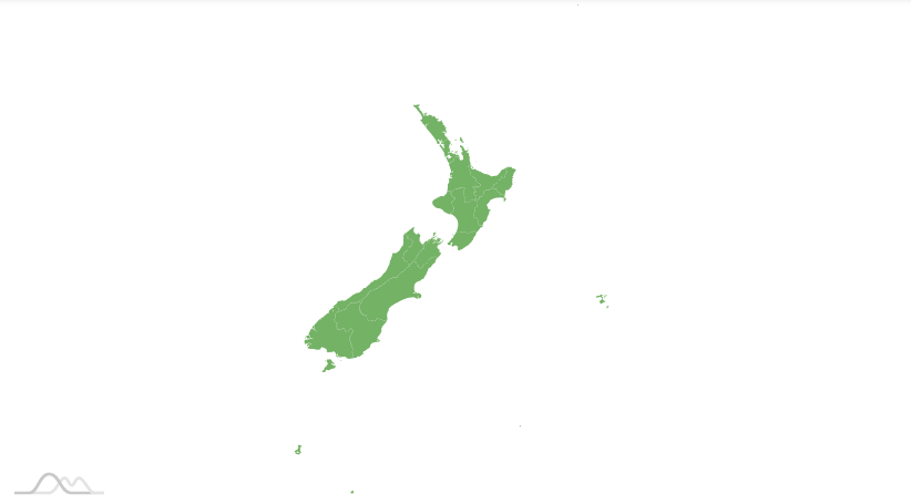
Some countries, like New Zealand have islands across that line. This causes the "over the line" parts to be "wrapped" and drawn all the way to the right of the map area. This may not be an issue on a world map, but might look a bit odd for a country only map.
The issue
As we described in preamble, some country maps might look outright odd with their parts that cross anti meridian drawn on the opposite side of the map:

The fix
The solution is easy: we just need to "rotate" the map so that "stray" islands fit next to the mainland.
For that we have deltaLongitude setting of the map.
chart.deltaLongitude = -10;
chart.deltaLongitude = -10;
{
  // ...
  "deltaLongitude": -10
}
Setting it to -10 will shift the whole map westwards by 10 degrees, which is enough for all of the islands to fit, producing the map as we expect it:
Example
See the Pen amCharts 4: "fixing" map of New Zealand by amCharts team (@amcharts) on CodePen.